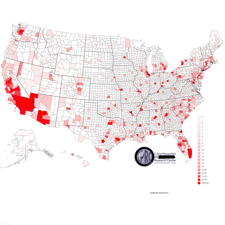
But Damn! the map of murders by county and the 2016 election map by county (Blue or red voting) sure shows some interesting parallels.
Using Liberal Logic, one could assume that Democrats (or people voting for Hillary, at least) are some homicidal maniacs.....
Which, in one way, makes me wonder if that is why they so want Gun Control....they know what is in their hearts, and assume that it is in ours as well.
I'm thinking there are some cultural factors there as well, but the parallels are still there.
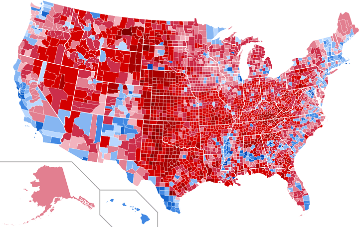 | ||
2016 election map by county
|
5 comments:
It would be interesting to see murder rate (homicides per 100,000) and the election map.
That would wash out the potential shared factor of population density. High population density breeds hive-mind (Liberals) and there are more murders because there are more people to murder.
Joe: If you can find that data, Especially in a map form, I'd love to see it as well.
And all that red on the homicide map in Southern California... it has nothing to do with illegal immigration... nothing at all... nope...
Map. https://demographics.virginia.edu/DotMap/index.html
Source page. https://demographics.coopercenter.org/racial-dot-map/
Make of it what you will.
http://pix11.com/2015/05/08/by-the-numbers-here-are-the-most-dangerous-cities-in-america/
Image here: https://tribwpix.files.wordpress.com/2015/05/crime.jpg?quality=85&strip=all&w=770&h=441
The data is a little bit suspect. For example, why would Kentucky have so little crime? Looking at crime rates in Michigan, December has only sixty percent as much crime as any other month. The reason is reporting. Local jurisdictions have drop-dead timelines and not all crime committed in December makes it to the report. I suspect jurisdictions are tempted to not report EVERYTHING because it might make them look bad.
One thing that jumps out as a Michigan person is how "crime rate" follows interstate corridors. You can clearly see the I-94 and I-75 corridor.
Take it for what it is worth.
Post a Comment